What’s In a Name? (You don’t want to know!)

IMG_2389 for blog_edited-2Let me start off with a disclaimer.

I’m going to repeat an entertaining legend, but I don’t really know how much truth it contains.  I first heard it while living in the city of Pampa, in the Texas Panhandle, back in the late ‘70s. I don’t know the origin of this legend and since I’m not a native of that area, I have, as they say, “no dog in this hunt…”

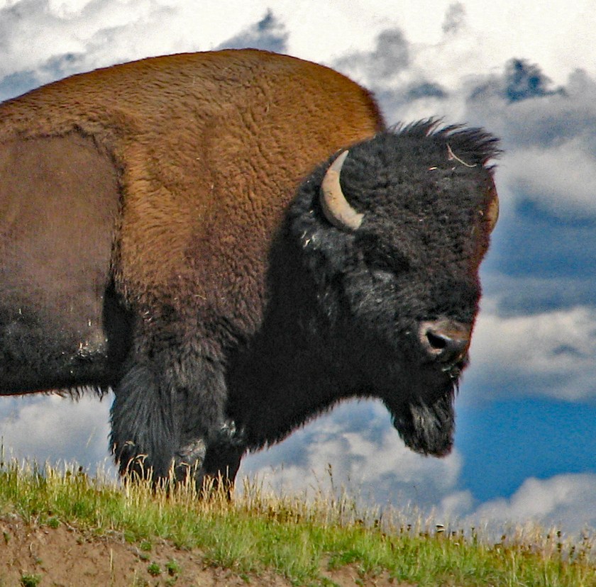
Let’s start with what we do know.  Back in the 1870s (no, not the same ‘70s I mentioned above) a settlement grew out of a buffalo hunter camp about twenty miles from present-day Pampa. (Technically, they are bison, not buffalo, but let’s not split hairs on this one.)  It was a rough-and-tumble kind of place through which a lot of well-known people passed.  About the same time, the Army established a fort in the area.  According to a website I found (link below) one of the famous people who passed through acquired a lifelong memory of his time there.  Bat Masterson, of Dodge City fame, is described as walking with a limp.  It seems that he acquired that limp in a gun fight with an Army sergeant over a card game and dance hall girl.  The only survivor, Masterson, had been shot in the pelvis.  If you find a reference, you’ll see that the altercation occurred in Sweetwater, Texas.  But it’s not the Sweetwater you think…

This Panhandle town had been established on the banks of the Sweetwater Creek so it naturally assumed the name of Sweetwater.  This is where the story gets more entertaining.

In 1879, Wheeler County was established and Sweetwater was the natural choice as the county seat.  The problem came when they petitioned for a post office.  The petition was rejected because there was already another Sweetwater, Texas – the one you know.  That obviously created a problem because the town had been using that name for a few years.

Now, for the story as I heard it:

After the town was denied the use of “Sweetwater,” and while trying to decide on a new name, an old Indian chief suggested that the town use the Indian term for sweet water – mobeetie.  It was quickly agreed upon, approved, and Mobeetie, Texas was born.  Sometime later, it was discovered that the old chief had the last laugh.  Mobeetie didn’t actually mean “sweet water” – it meant “buffalo dung.”

It’s a good story, but I didn’t give it much credibility.

I don’t remember how it came up in the conversation, but I told the story to a friend over breakfast the other day.  Afterward, I realized it might be fun to write up for Casual Comments.  I started doing a little research since all I knew about the town was the name, location, the legend and that I remembered seeing a sign on the highway that points one direction for Mobeetie and another for Old Mobeetie.  I found a great website that offers the town’s history – in much greater detail.  Much to my surprise, it told the same story of the name with a little more detail and a couple of minor differences!  So, now I’ve confirmed the validity of the story.  After all, it’s on the Internet, so it must be true…!

To read more, visit this really interesting website:

http://www.legendsofamerica.com/tx-mobeetie.html

Hair today…gone tomorrow…

There exists a photograph, a snapshot really, of a young man standing with his mother on the southwest rim of the Palo Duro Canyon in the Texas Panhandle. Taken in the early 1970s, his hairstyle is completely appropriate for the time.  His hair was long, but not overly so.  On a normal day, it would have been combed and parted and neat. He was tall – six-foot three – thin, slightly tanned, and his hair was naturally a dark brown color which matched his mustache and very dark brown eyes.

That day, however, his hair was sun-bleached to an almost red color – not uncommon whenever he spent some time in the sun. The Texas Panhandle is largely a prairie and notorious for things such as its hot, very dry climate, and constant wind. The average daily wind is 14 mph. That may not sound like much, but there are a number of days when the wind doesn’t blow enough to speak of, so to average out at 14, means there are days when it really blows! There are occasions when the measured wind velocity between Amarillo’s downtown buildings hits 100+ mph. Those times tend to be a bit expensive for the insurance companies who pay for the damages done. The hot, dry summer wind that day was apparently a little above the average and as evidenced by his hair. It was wild…unkempt even – the result of all of these factors and the fact that it was naturally very curly. It looked like a reddish “Fro”.

Ask anyone with naturally curly hair if they like it and more often than not, you’ll get a negative response – especially the younger crowd. It is hard to control – it literally seems to have a mind of its own. It is harder to cut because the curls may be tighter one day than the next. So the hairstyle can vary with the humidity, the weather, the wind, the way it was slept on, etc., etc. At times it even seems to vary with owner’s attitude that day – or maybe it’s the attitude that varies based on how attractive the hair looks… Either way, the result doesn’t vary – it is still difficult to deal with. But maybe not for much longer…

In the July, 2016 volume of National Geographic magazine, there is a short article discussing some of the characteristics of curly hair. According to the article, studies published in the journal of the American Physical Society describe the hair shaft as a very complex structure – influenced by gravity, texture and the shape of the follicle it grows from. Apparently, an asymmetrical follicle produces curly hair and the longer the hair grows, the more complex the structure. The more complex the structure, the more susceptible to heat. So Purdue University is investigating the styling temperatures best suited to maintaining healthy curly hair.

Having been that young man in the photograph and having not used heat to style my hair, I can attest to the fact that it did not contribute to having little remaining volume or that my much shorter hair is now controllable by a fine-toothed comb…

Texas Panhandle

A recent trip to Amarillo, in the Texas Panhandle, brought back memories of younger days. My wife and I met and married there – and one of our daughters was born there.  It is a great town…city…but often overlooked as people pass through on I-40 heading east or west, and to a lesser extent, I-27 as people go north or south.  It is usually seen as a good stopping point to spend the night because the next larger cities are 100 miles south, 280 miles west, 240 miles east, or 360 miles north.  Not enough people pause long enough to explore the area.

For those unfamiliar with the term or the geographical region, the Texas Panhandle is the northern rectangle of the state that consists of 26 counties bordered by the states of Oklahoma and New Mexico.  (Not to be confused with the country of Mexico that borders the southern edge of Texas.)

About twenty miles south of Amarillo is the Palo Duro Canyon.  Seventy miles long, averaging about six miles wide, and up to 1,000 feet deep, it is second only to the Grand Canyon!  In the canyon itself are a number of things to see and do – camping, hiking, horseback riding, and a musical drama called “Texas” which is performed in a beautiful amphitheater with a backdrop of a section of the canyon wall.  The entire cast are amateurs but they are very good!  It is an entertaining play – well worth the time, effort and cost to see.

But it is the canyon itself, combined with the indigenous fauna, that is the real draw.  The rocks vary from the normal sandy-colored dirt of the Panhandle at the very top and the off-white of the Ogallala aquifer just below, to the iron-oxide rich red claystone near the bottom.  In between, varying rock layers elicit streaks of white, gray, yellow and even lavender.  One of the prominent features in the canyon is the formation named the “Lighthouse”.  I have hiked up to the base of the Lighthouse…if you want to call it a hike.  It is actually a nice walk across fairly even terrain.  You can choose to observe it from your car and it is still impressive, but either way, never more impressive than with a typical Panhandle sunset.

Panhandle sunsets are often spectacular.  The sky, with no mountains and few other obstructions, stretches from horizon to horizon. Add a few clouds and as the sun retreats from view, the colors are amazing!  Bright gold in the west, with patches of orange shading gradually darker as your gaze traverses toward the east.  All on a background of blue darkening to indigo as time slips away…but in the canyon…

The last rays of the sun seem to ignite a beacon in the Lighthouse and along the rim of the canyon where the Ogallala lies.  The bright rust-red rock below the rim begins its daily journey to darker hues, passing through ruby to wine and ultimately to a dark, dark mahogany as another day draws to a close and it is time to rest and restore your soul for the morrow.